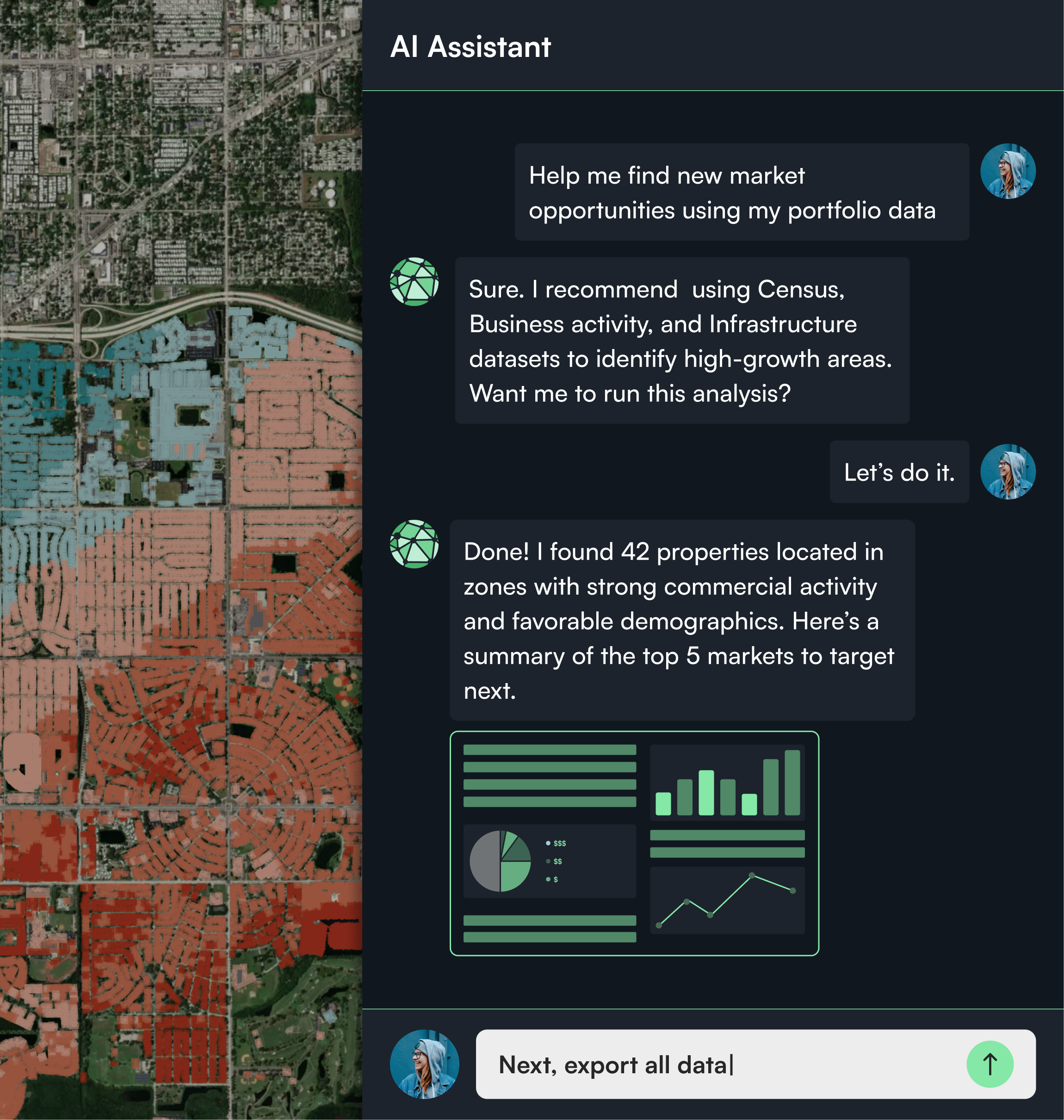
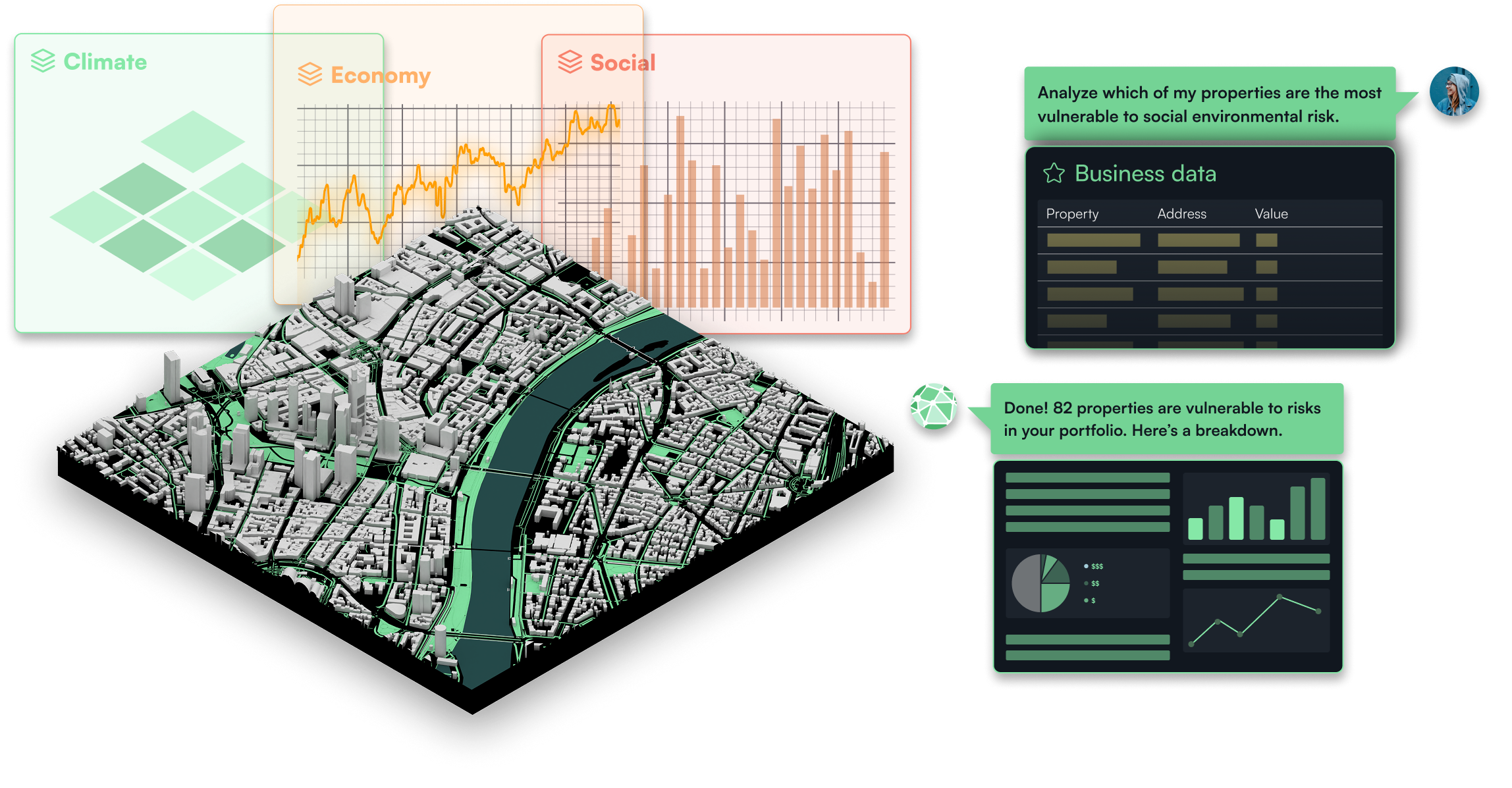
Upload your data, add contextual layers, and use natural language to explore patterns, exposure, and opportunity.
Bring your own data
Upload portfolios, policies, or asset data directly into Studio to create a base layer for analysis and kick off your geospatial analysis instantly.
Layer rich context
Add data layers from Neural Earth’s catalog to expand your view and reveal patterns, relationships, and context across every location.
Turn questions into spatial insights
Ask questions, request summaries, or generate maps. Studio turns your words into spatial analysis in seconds.
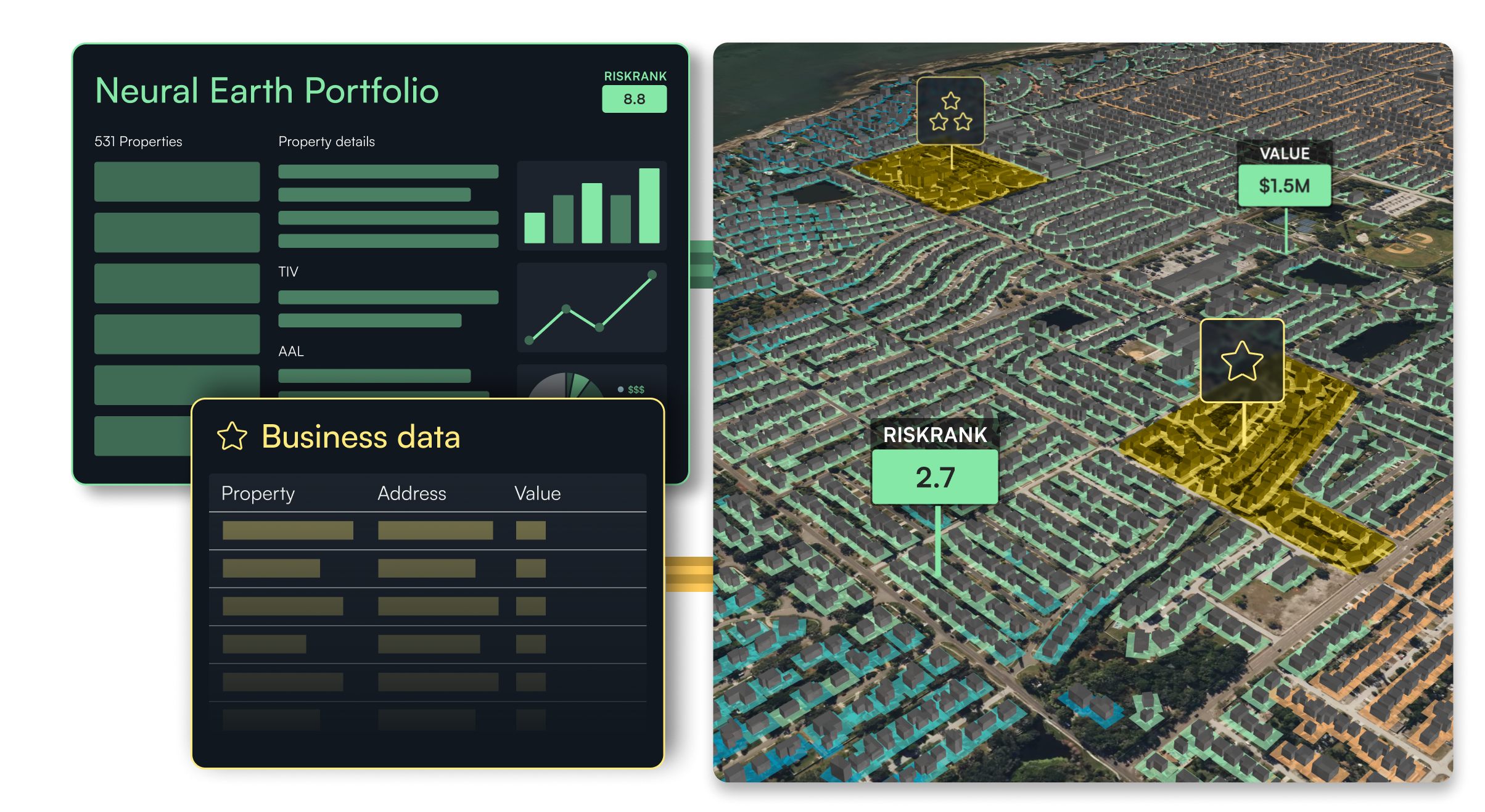
Analytics
Unify all your property, hazard, and portfolio data in a single place.
A data library to expand insights.
Access hundreds of curated datasets, from hazard models to demographics to layer, compare, and enrich your perspective.
Take your Risk insights further in Studio.
Transfer data from Risk in seconds to reveal layers of insight and see your portfolio from every angle.
Use cases
Turn complex challenges into simple workflows.
Asset targeting opportunities
Bring your assets into Studio to spot where exposure, hazard intensity, or operational signals converge. Quickly surface properties that show elevated risk or strategic potential, and prioritize where to focus acquisition, mitigation, or divestment efforts.
Market signal applied to portfolio holdings
Blend valuation, parcel, and hazard layers with your own data to uncover market shifts. See which assets sit near growth corridors, infrastructure upgrades, or changing risk zones, and act on early signals that could reshape demand or exposure.
Correlative analytics & derived market signal
Reveal relationships between valuation trends, parcel characteristics, and hazard intensities. Surface assets positioned in shifting market zones—growth corridors, redevelopment areas, or rising-risk regions—to anticipate exposure changes before they materialize.
Contextually aware scenario modeling
Test how value, risk, and location attributes change under different assumptions. Apply filters, thresholds, and natural language queries to reveal concentration hotspots, isolate high-impact segments, and guide portfolio strategy with contextual insight.
Real time and pre-emptive decision making
Map your portfolio RiskRank scores, peril drivers and business data to highlight emerging clusters or outliers. Compare exposure across asset types and locations, and anticipate where rising risk could influence underwriting, capital planning, or asset performance.
Request a demo
Discover how Neural Earth Studio lets you combine geospatial data and AI to explore markets and surface new opportunities.
Request a demo
Discover how Neural Earth helps you deploy data, analyze assets, and assess risk using AI-powered geospatial intelligence.
Request early access to Risk
Be among the firsts to access AI-driven geospatial capabilities to analyze property-level risk and manage assets at scale.
Request early access to Studio
Be among the firsts to access AI-driven geospatial capabilities to explore markets and identify new opportunities.
Request early access to Neuron
Be among the firsts to access AI and geospatial infrastructure for data pipelines, models, and applications.
Request early access to Neural Earth
Be among the firsts to access Neural Earth and deploy data, explore markets, and manage risk using AI-powered geospatial intelligence.